Atm nearby ATM
Puerto Rico
Atm nearby ATM
ATM
Bulevar Miguel Pou, 00717, Ponce, San Antón, PR Puerto Rico
contacts phone
:
+1-787
Latitude:
18.012111
, Longitude:
-66.6011851
larger map & directions
read more
nearest Atm
251 m
ATM
Ponce
Atm
read more
1.268 km
ATH Banco Santander
Ponce
Atm
read more
1.269 km
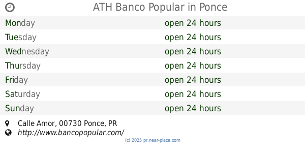
ATH Banco Popular
Calle Amor, Ponce
Atm
read more
1.366 km
Oriental Bank and Trust
507 Plazoleta Ponce Cash &, Ponce, PR 00728
Atm
read more
1.366 km
EZ Payments Inc.
Texaco El Monte, Ponce, PR
Atm
read more
1.422 km
ATM
Calle Concordia, Ponce
Atm
read more
1.446 km
ATM
8150 Calle Concordia, Ponce
Atm
read more
1.543 km
ATM
Calle Lisboa, Ponce
Atm
read more
2.162 km
Universicoop ATM
Ponce
Atm
read more
2.364 km
ATM Banco Popular
Avenida Santiago De Los Caballeros, Ponce
Atm
read more
2.396 km
Scotiabank De Puerto Rico
Munoz Rivera St, Ponce
Atm
read more
2.51 km
ATM Banco Popular
Universidad Interamericana, Recinto de, Ponce
Atm
read more
2.826 km
Banco santander
Ponce
Atm
read more
3.915 km
ATM Banco Popular
Ponce
Atm
read more
3.928 km
EZ ATM Leo's
Ponce
Atm
read more
6.248 km
Banco Popular
Puerto Rico 506, Coto Laurel
Atm
read more
6.248 km
ATH Banco Popular
Puerto Rico 506, Coto Laurel
Atm
read more
6.438 km
ATM
Avenue San Cristóbal, Coto Laurel
Atm
read more
10.511 km
ATM Banco Popular
Juana Díaz
Atm
read more
11.301 km
EZ Payments Inc.
Texaco Pastillo Service, Juana Diaz, PR 00795
Atm
read more
16.316 km
EZ Payments Inc.
Colmado Criado, Villalba, PR 00766
Atm
read more
17.427 km
ATM
Calle Luchetti, Villalba
Atm
read more
20.173 km
EZ Payments Inc.
Guayanilla Services, Guayanilla, PR 00656
Atm
read more
56.31 km
Cooperativa a/C Pepiniana
Ave Emerito Estrada #548, San Sebastian, PR 00685
Atm
read more
57.569 km
ATH Banco Popular
7006, Puerto Rico 693, Dorado
Atm
read more
📑
all categories
Accounting
Administrative area level 1
Administrative area level 2
Airport
Amusement park
Aquarium
Art gallery
Atm
Bakery
Bank
Bar
Beauty salon
Bicycle store
Book store
Bowling alley
Bus station
Cafe
Campground
Car dealer
Car rental
Car repair
Car wash
Casino
Cemetery
Church
City hall
Clothing store
Colloquial area
Convenience store
Country
Courthouse
Dentist
Department store
Doctor
Electrician
Electronics store
Embassy
Establishment
Finance
Fire station
Florist
Food
Funeral home
Furniture store
Gas station
General contractor
Grocery or supermarket
Gym
Hair care
Hardware store
Health
Hindu Temple
Home goods store
Hospital
Insurance agency
Jewelry store
Laundry
Lawyer
Library
Liquor store
Local government office
Locality
Locksmith
Lodging
Meal delivery
Meal takeaway
Mosque
Movie rental
Movie theater
Moving company
Museum
Natural feature
Neighborhood
Night club
Painter
Park
Parking
Pet store
Pharmacy
Physiotherapist
Place of worship
Plumber
Point of interest
Police
Political
Post office
Premise
Real estate agency
Restaurant
Roofing contractor
Route
Rv park, camping
School
Shoe store
Shopping mall
Spa
Stadium
Storage
Store
Subpremise
Supermarket
Synagogue
Taxi stand
Train station
Transit station
Travel agency
University
Veterinary care
Zoo
sublocality level 1
↑