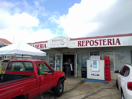
Bakery nearby La Cuchilla
Puerto Rico
Bakery nearby La Cuchilla
La Cuchilla
&, Carr. 155 & PR-143, Orocovis Puerto Rico
contacts phone
:
+1-787
Latitude:
18.1652025
, Longitude:
-66.4057079
read more
nearest Bakery
La Cuchilla
&, Carretera 155 & Puerto Rico 143, Orocovis
Bakery
read more
3.651 km
Ayales De Coamo Panaderia
Bakery
read more
6.744 km
Carvel
Km 6.6 Bo.Cedro Arriba, Naranjito
Bakery
read more
7.778 km
Lugo's Bakery
Helechal
Bakery
read more
8.064 km
El Caviar de los Dulces - Bistro & Coffee Shop
Puerto Rico 157, Orocovis
Bakery
read more
8.334 km
Panaderia Y Reposteria El Nuevo Pino
Puerto Rico 151, Villalba
Bakery
read more
9.447 km
Panaderia Helechal
Helechal
Bakery
read more
9.575 km
Panaderia Favio Sports Bakery
Bakery
read more
9.704 km
Urb. La Vega
Calle Mc Jones, Villalba
Bakery
read more
10.121 km
Panadería El Cañón
Helechal
Bakery
read more
10.262 km
Don Vale
Coamo
Bakery
read more
10.534 km
Centro Dulces Aponte
43 Calle Santiago Iglesias, Coamo
Bakery
read more
10.59 km
La Tiendita De Reposteria
37 Calle Luis Muñoz Rivera, Aibonito
Bakery
read more
10.855 km
Miranda's Bakery
Bakery
read more
11.795 km
Alba Bakery
00766
Bakery
read more
11.81 km
Angel's Bakery
Bakery
read more
12.322 km
Dulcería Lelolai
Bo. Jagüeyes, PR-149, Villalba
Bakery
read more
12.559 km
Panaderia Kamila's
Los Llanos
Bakery
read more
12.669 km
Panaderia Y Reposteria La Panoramica
Bakery
read more
13.266 km
La Aiboniteña Panaderia Y Reposteria
Bakery
read more
14.255 km
Palacio Bakery
00705,
Bakery
read more
14.663 km
Panaderia high bakery #2
PR-, Puerto Rico 152, Barranquitas
Bakery
read more
15.062 km
Originals Bakery
275 Calle Federico Degetau, Aibonito
Bakery
read more
16.168 km
Juana Diaz Bakery
Calle Tomás Carrión Maduro Esquina #73, Juana Díaz
Bakery
read more
16.273 km
Roma Bakery
113-115 Calle Comercio, Juana Díaz
Bakery
read more
📑
all categories
Accounting
Administrative area level 1
Administrative area level 2
Airport
Amusement park
Aquarium
Art gallery
Atm
Bakery
Bank
Bar
Beauty salon
Bicycle store
Book store
Bowling alley
Bus station
Cafe
Campground
Car dealer
Car rental
Car repair
Car wash
Casino
Cemetery
Church
City hall
Clothing store
Colloquial area
Convenience store
Country
Courthouse
Dentist
Department store
Doctor
Electrician
Electronics store
Embassy
Establishment
Finance
Fire station
Florist
Food
Funeral home
Furniture store
Gas station
General contractor
Grocery or supermarket
Gym
Hair care
Hardware store
Health
Hindu Temple
Home goods store
Hospital
Insurance agency
Jewelry store
Laundry
Lawyer
Library
Liquor store
Local government office
Locality
Locksmith
Lodging
Meal delivery
Meal takeaway
Mosque
Movie rental
Movie theater
Moving company
Museum
Natural feature
Neighborhood
Night club
Painter
Park
Parking
Pet store
Pharmacy
Physiotherapist
Place of worship
Plumber
Point of interest
Police
Political
Post office
Premise
Real estate agency
Restaurant
Roofing contractor
Route
Rv park, camping
School
Shoe store
Shopping mall
Spa
Stadium
Storage
Store
Subpremise
Supermarket
Synagogue
Taxi stand
Train station
Transit station
Travel agency
University
Veterinary care
Zoo
sublocality level 1
↑