Bar nearby Colmado La Curvita
Puerto Rico
Bar nearby Colmado La Curvita
Colmado La Curvita
contacts phone
:
+1-787
Latitude:
18.1703053
, Longitude:
-66.0427656
read more
nearest Bar
1.302 km
Rinconcito Boricua
Puerto Rico 761
Bar
read more
2.283 km
Balcon de Felix
Bar
read more
2.464 km
Gallera Borinquen Caguas
Puerto Rico 763, Caguas
Bar
read more
2.985 km
The New Riverside Bar
Caguas
Bar
read more
3.234 km
Chino's Place Bar
PR-7788, San Lorenzo
Bar
read more
3.505 km
Cafetería Ayala
Bar
read more
3.557 km
Vistas de la Loma
Carr. 181 Rm. 765 Km. 3.5, San Lorenzo
Bar
read more
3.599 km
La Loma De Javier
Jagual
Bar
read more
3.829 km
Rumbon La Fuente Lunch Break
Puerto Rico 1, Caguas
Bar
read more
4.038 km
La Ruta Bar Tomas De Castro
Puerto Rico 788, Caguas
Bar
read more
4.162 km
Colmado El Resuelve Caguas
103-115 Calle Fraternidad, Caguas
Bar
read more
4.653 km
Wanabí
Puerto Rico 7784, Caguas
Bar
read more
4.907 km
El Meson Criollo
Avenida Pino, Caguas
Bar
read more
5.007 km
La Cima
Bar
read more
5.037 km
Apolo 12
Jagual
Bar
read more
5.171 km
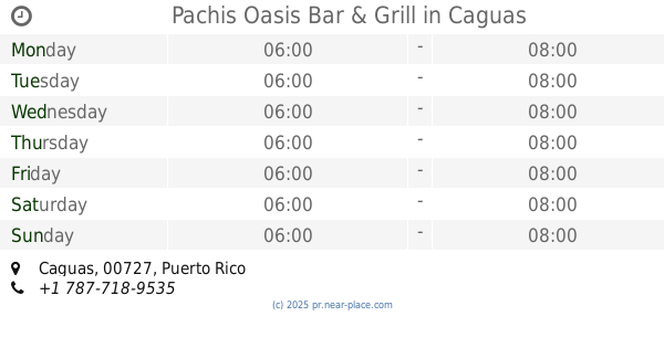
Pachis Oasis Bar & Grill
Caguas
Bar
read more
5.251 km
Flecha's Sport Bar & Mini Mart
Puerto Rico 789, Caguas
Bar
read more
5.302 km
La Guarida
Puerto Rico, Cayey
Bar
read more
5.318 km
Agencia Hipica 037
Puerto Rico 172, Caguas
Bar
read more
5.318 km
Agencia Hipica 602
Puerto Rico 172, Caguas
Bar
read more
6.107 km
Palo Alto Bar
Puerto Rico, PR-745, San Lorenzo
Bar
read more
6.195 km
Creolé
136 Calle Gauthier Benitez, Caguas
Bar
read more
11.201 km
Agencia Hipica 623
Puerto Rico 734, Cidra
Bar
read more
14.655 km
El Nuevo Jibarito
Bar
read more
14.806 km
La Cabaña
Carretera 798 Intersección, Puerto Rico 1, Caguas
Restaurant
Bar
Food
Point of interest
Establishment
read more
📑
all categories
Accounting
Administrative area level 1
Administrative area level 2
Airport
Amusement park
Aquarium
Art gallery
Atm
Bakery
Bank
Bar
Beauty salon
Bicycle store
Book store
Bowling alley
Bus station
Cafe
Campground
Car dealer
Car rental
Car repair
Car wash
Casino
Cemetery
Church
City hall
Clothing store
Colloquial area
Convenience store
Country
Courthouse
Dentist
Department store
Doctor
Electrician
Electronics store
Embassy
Establishment
Finance
Fire station
Florist
Food
Funeral home
Furniture store
Gas station
General contractor
Grocery or supermarket
Gym
Hair care
Hardware store
Health
Hindu Temple
Home goods store
Hospital
Insurance agency
Jewelry store
Laundry
Lawyer
Library
Liquor store
Local government office
Locality
Locksmith
Lodging
Meal delivery
Meal takeaway
Mosque
Movie rental
Movie theater
Moving company
Museum
Natural feature
Neighborhood
Night club
Painter
Park
Parking
Pet store
Pharmacy
Physiotherapist
Place of worship
Plumber
Point of interest
Police
Political
Post office
Premise
Real estate agency
Restaurant
Roofing contractor
Route
Rv park, camping
School
Shoe store
Shopping mall
Spa
Stadium
Storage
Store
Subpremise
Supermarket
Synagogue
Taxi stand
Train station
Transit station
Travel agency
University
Veterinary care
Zoo
sublocality level 1
↑