Church nearby Parroquia Cristo Rey
Puerto Rico
Church nearby Parroquia Cristo Rey
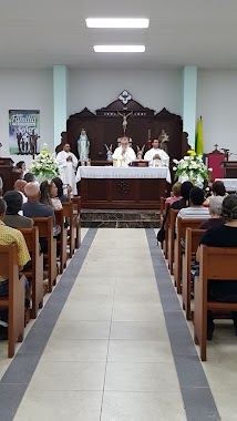
Parroquia Cristo Rey
Palos Blancos, Corozal 00783, Puerto Rico
contacts phone
:
+1-787
Latitude:
18.2962953
, Longitude:
-66.3150172
larger map & directions
read more
nearest Church
2.245 km
Iglesia Cristiana Discípulos de Cristo en Barrio Negros, Corozal
00783
Church
read more
2.687 km
Capilla NS Divina Providencia
Church
read more
2.994 km
Iglesia Movimiento Misionero Mundial
Puerto Rico 568
Church
read more
3.213 km
Capilla Santa Teresita
Church
read more
3.347 km
Iglesia De Dios MB De Betania
Church
read more
3.795 km
Capilla NS de Fátima
Church
read more
3.808 km
Ministerio Jehova Yireh
00783
Church
read more
3.84 km
Iglesia Senda De Renovacion Y Restauracion
Church
read more
3.868 km
Parroquia Santuario La Milagrosa
PR-801, Corozal
Church
read more
4.003 km
Iglesia de Restauración Jehová Jireh
802 Km 9, 4 Puerto Rico 164, Bayamón
Church
read more
4.048 km
ICDC Palmarito
Church
read more
4.183 km
Iglesia Evangelica Pentecostal Cedro Abajo Naranjito
Church
read more
4.232 km
Iglesia Adventista
Calle Gándara, Corozal
Church
read more
4.286 km
Igl. Adventista del 7mo Día -Corozal
Corozal
Church
read more
4.414 km
Iglesia de Dios Mission Board
Calle 4, Corozal
Church
read more
4.438 km
Iglesia De Dios Pentecostal M. I., Palmarejo, Corozal
Corozal
Church
read more
4.538 km
Capilla San Jose
Church
read more
4.681 km
Capilla San Judas Tadeo
PR-8811, Corozal
Church
read more
4.711 km
Ministerios Unidos La Gran Cosecha
00783
Church
read more
4.711 km
Ministerios Unidos
00783
Church
read more
4.898 km
IGLESIA CRISTIANA LA ERA DE ALABANZAS Y MINISTRACION
Urb Maria del Carmen Carr 164 km 16.2
Church
read more
4.899 km
Holy Family Parish
Puerto Rico 807, Corozal
Church
read more
4.907 km
Iglesia Adventista de Corozal
00783
Church
read more
5.01 km
Iglesia Cristiana A Dios Sea La Gloria
O'Neill, 8, Calle O'Neill, Corozal
Church
read more
5.079 km
Capilla Perpetuo Socorro
Corozal
Church
read more
📑
all categories
Accounting
Administrative area level 1
Administrative area level 2
Airport
Amusement park
Aquarium
Art gallery
Atm
Bakery
Bank
Bar
Beauty salon
Bicycle store
Book store
Bowling alley
Bus station
Cafe
Campground
Car dealer
Car rental
Car repair
Car wash
Casino
Cemetery
Church
City hall
Clothing store
Colloquial area
Convenience store
Country
Courthouse
Dentist
Department store
Doctor
Electrician
Electronics store
Embassy
Establishment
Finance
Fire station
Florist
Food
Funeral home
Furniture store
Gas station
General contractor
Grocery or supermarket
Gym
Hair care
Hardware store
Health
Hindu Temple
Home goods store
Hospital
Insurance agency
Jewelry store
Laundry
Lawyer
Library
Liquor store
Local government office
Locality
Locksmith
Lodging
Meal delivery
Meal takeaway
Mosque
Movie rental
Movie theater
Moving company
Museum
Natural feature
Neighborhood
Night club
Painter
Park
Parking
Pet store
Pharmacy
Physiotherapist
Place of worship
Plumber
Point of interest
Police
Political
Post office
Premise
Real estate agency
Restaurant
Roofing contractor
Route
Rv park, camping
School
Shoe store
Shopping mall
Spa
Stadium
Storage
Store
Subpremise
Supermarket
Synagogue
Taxi stand
Train station
Transit station
Travel agency
University
Veterinary care
Zoo
sublocality level 1
↑