Gas station nearby Violetas Service Station
Puerto Rico
Gas station nearby Violetas Service Station
Violetas Service Station
contacts phone
:
+1-787
Latitude:
18.2871482
, Longitude:
-66.3185905
read more
nearest Gas station
3.229 km
Limon Auto Body
Padilla
Gas station
read more
3.503 km
Gulf Gas Station and Mini Market
Gas station
read more
4.796 km
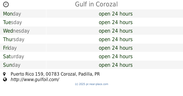
Gulf
Puerto Rico 159, Corozal
Gas station
read more
4.829 km
Ecomaxx Naranjito
Gas station
read more
4.892 km
SanFeliz SS. Corozal
00783
Gas station
read more
6.251 km
Puma Gas Station 336
Puerto Rico 152
Gas station
read more
6.251 km
Puma Gas Station
Puerto Rico 152
Gas station
read more
6.252 km
Oasis Service Station (Puma)
Puerto Rico 152, Comerío
Gas station
read more
6.596 km
Cancha Cibuco 3
Padilla
Gas station
read more
9.822 km
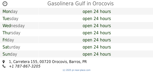
Gasolinera Gulf
1 Carretera 155, Orocovis
Gas station
read more
10.125 km
Shell
Calle Ramos Antonini, Orocovis
Gas station
read more
10.159 km
Gulf Torres Casanova
Puerto Rico 152, Barranquitas
Gas station
read more
12.519 km
Puma Gas Station
Carr 167, Bayamón
Gas station
read more
12.667 km
Gulf
Puerto Rico 155
Gas station
read more
12.872 km
Total
CARR. 165, KM. 10.6, Barrio Contorno, Toa Alta
Gas station
read more
13.005 km
Shell
Carretera 861, Toa Alta
Gas station
read more
13.008 km
Shell
PR-861, Toa Alta
Gas station
read more
13.346 km
TOTAL Tankstelle
PR- 861, Km. 6.9, Bo. Piñas, Toa Alta
Gas station
read more
13.378 km
TOTAL Tankstelle
Helechal
Gas station
read more
13.557 km
Total
Carr. 2, Km. 27.7, Dorado
Gas station
read more
16.445 km
Gasolinera American
Bo.Campanillas Toa Baja
Gas station
read more
16.988 km
Puma 284
Puerto Rico 861, Bayamón
Gas station
Point of interest
Establishment
read more
17.851 km
Mega Lube
Avenida Castiglioni, Bayamón
Gas station
read more
18.548 km
Puma
Carr. 2, Bayamón
Gas station
read more
20.714 km
Gulf Station Bayamon
Puerto Rico 872, Bayamón
Gas station
read more
📑
all categories
Accounting
Administrative area level 1
Administrative area level 2
Airport
Amusement park
Aquarium
Art gallery
Atm
Bakery
Bank
Bar
Beauty salon
Bicycle store
Book store
Bowling alley
Bus station
Cafe
Campground
Car dealer
Car rental
Car repair
Car wash
Casino
Cemetery
Church
City hall
Clothing store
Colloquial area
Convenience store
Country
Courthouse
Dentist
Department store
Doctor
Electrician
Electronics store
Embassy
Establishment
Finance
Fire station
Florist
Food
Funeral home
Furniture store
Gas station
General contractor
Grocery or supermarket
Gym
Hair care
Hardware store
Health
Hindu Temple
Home goods store
Hospital
Insurance agency
Jewelry store
Laundry
Lawyer
Library
Liquor store
Local government office
Locality
Locksmith
Lodging
Meal delivery
Meal takeaway
Mosque
Movie rental
Movie theater
Moving company
Museum
Natural feature
Neighborhood
Night club
Painter
Park
Parking
Pet store
Pharmacy
Physiotherapist
Place of worship
Plumber
Point of interest
Police
Political
Post office
Premise
Real estate agency
Restaurant
Roofing contractor
Route
Rv park, camping
School
Shoe store
Shopping mall
Spa
Stadium
Storage
Store
Subpremise
Supermarket
Synagogue
Taxi stand
Train station
Transit station
Travel agency
University
Veterinary care
Zoo
sublocality level 1
↑