places in Juncos
Puerto Rico
Juncos
Juncos
Administrative Region:
Juncos
population:
40 290
calling code:
+1-787-787
+1-787-939
postcode:
00777
Location on the map of Puerto Rico
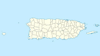
Juncos
Pharmacy
Farmacia la Inmaculada, Inc.
5 Calle Dr. Almodovar, Juncos
Pharmacy
read more
Walgreens Pharmacy
State Road 31 Km. 24.0, Juncos Plaza Shopping Ctr, Juncos
Pharmacy
read more
Farmacia Rey
00777
Pharmacy
read more
FARMACIA NIEVES
Pharmacy
read more
Farmacia del Pueblo 2
23 Calle Muñoz Rivera, Juncos
Pharmacy
read more
Farmacia Borinquen
Esq Corchado, #16 Calle Dr. Barreras, Juncos
Pharmacy
read more
Pharmacy Town 2
23 Calle Muñoz Rivera, Juncos
Pharmacy
read more
Farmacia Borinquen
Calle Barreras, esq, Calle Corchado, Juncos
Pharmacy
read more
Premise
Estacionamiento Iglesia de Cristo en Cubuy
Juncos
Premise
read more
Plaza del Soldado
Juncos
Premise
read more
La Cima Apartments
Juncos
Premise
read more
Shopping mall
Pulguero San Lorenzo
Carretera 181, Juncos
Shopping mall
read more
Pulguero San Lorenzo
Puerto Rico 181, Juncos
Shopping mall
read more
Juncos Plaza Shopping Center
1 State Road 31, Juncos
Shopping mall
read more
EM FABRICATIONS
km, 22 Calle 4, Juncos
Shopping mall
read more
Cancha Amalbert Juncos Seminario Nanny
Shopping mall
read more
Autozone
Rico, Juncos
Shopping mall
read more
Galería Juncos
Puerto Rico 31, Juncos
Shopping mall
read more
Juncos Plaza Shopping Center (National y Capri)
Juncos
Shopping mall
read more
Stadium
Mariano Nini Meaux Stadium
Stadium
Point of interest
Establishment
read more
Estadio Doble AA Mariano Mini Meaux
Juncos
Stadium
read more
Parque Los Almendros Juncos
00777
Stadium
read more
Estadio Mariano Nini Meaux
Stadium
read more
Mariano Nini Meaux Stadium
Juncos
Stadium
Point of interest
Establishment
read more
Supermarket
Residencial Narciso Varona
Calle Rosa, Juncos
Supermarket
read more
Amigo
Supermarket
read more
Supermercados Amigo
Supermarket
Grocery or supermarket
Food
Point of interest
Store
Establishment
read more
📑
Juncos all categories
Accounting
Administrative area level 1
Atm
Bakery
Bank
Bar
Beauty salon
Bicycle store
Cafe
Car dealer
Car repair
Car wash
Cemetery
Church
City hall
Clothing store
Convenience store
Courthouse
Dentist
Department store
Doctor
Electronics store
Establishment
Finance
Fire station
Florist
Food
Funeral home
Furniture store
Gas station
General contractor
Grocery or supermarket
Gym
Hair care
Hardware store
Health
Home goods store
Hospital
Insurance agency
Laundry
Library
Local government office
Locality
Lodging
Movie rental
Moving company
Natural feature
Neighborhood
Night club
Painter
Park
Parking
Pharmacy
Place of worship
Point of interest
Police
Post office
Premise
Restaurant
Roofing contractor
Route
School
Shoe store
Shopping mall
Spa
Stadium
Storage
Store
Supermarket
University
Veterinary care
sublocality level 1
↑