Restaurant nearby El Pico de Juanma
Puerto Rico
Restaurant nearby El Pico de Juanma
El Pico de Juanma
Puerto Rico 115, Aguada Puerto Rico
contacts phone
:
+1-787
Latitude:
18.3825536
, Longitude:
-67.2052873
read more
nearest Restaurant
543 m
The Island Bar & Restauran
Aguada
Restaurant
read more
566 m
Fogata Beach
Restaurant
read more
569 m
La Costa Sports and Friends
Camino Playa, Aguada
Restaurant
read more
673 m
La Reina de la Empanadilla y el Sabor - Food Truck
12 Puerto Rico 115, Aguada
Restaurant
read more
683 m
Chef Manuel
Carretera 441 Km 21.0, Bo. Guaniquilla, Aguada
Restaurant
read more
712 m
ode
Camino Playa, Aguada
Restaurant
read more
758 m
Jardin Cafeto
Restaurant
read more
769 m
El Galeón
Aguada
Restaurant
read more
832 m
Pikadera
00602
Restaurant
read more
870 m
Marullo's by Modo Mio Cuisine
PR-441 km1, Camino Playa, Aguada
Restaurant
read more
880 m
Waves Seafoo Restaurant
Restaurant
read more
888 m
La Papa
Puerto Rico 115
Restaurant
read more
896 m
McDonald's
Puerto Rico 115, Aguada
Restaurant
read more
949 m
Antonino's Pizza Aguada
Aguada Shoping Center Aguada, Puerto Rico
Restaurant
read more
999 m
Kris Pizza
Puerto Rico 115, Aguada
Restaurant
read more
1.036 km
La Bravata
Restaurant
read more
1.046 km
D&Y Hot Potatoes
Puerto Rico 115, Aguada
Restaurant
read more
1.276 km
Guayabo's Tropical Sunset
Puerto Rico 115
Restaurant
read more
1.464 km
Limbers
Puerto Rico 115, Aguada
Restaurant
read more
1.546 km
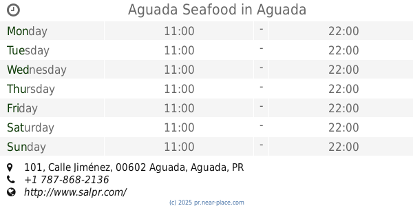
Aguada Seafood
199, 101 Calle Jiménez, Aguada
Restaurant
read more
1.623 km
El Chapo Burger
262-298 Calle Cristóbal Colón, Aguada
Restaurant
read more
1.756 km
Casa Linda Panoramoc Restaurant
Puerto Rico
Restaurant
read more
1.822 km
Chili's Fried Chicken
Restaurant
read more
1.979 km
Sazón D' Madre
Calle B, Aguada
Restaurant
read more
2.049 km
Red Trees
Avenida Nativo Alers, Aguada
Restaurant
read more
📑
all categories
Accounting
Administrative area level 1
Administrative area level 2
Airport
Amusement park
Aquarium
Art gallery
Atm
Bakery
Bank
Bar
Beauty salon
Bicycle store
Book store
Bowling alley
Bus station
Cafe
Campground
Car dealer
Car rental
Car repair
Car wash
Casino
Cemetery
Church
City hall
Clothing store
Colloquial area
Convenience store
Country
Courthouse
Dentist
Department store
Doctor
Electrician
Electronics store
Embassy
Establishment
Finance
Fire station
Florist
Food
Funeral home
Furniture store
Gas station
General contractor
Grocery or supermarket
Gym
Hair care
Hardware store
Health
Hindu Temple
Home goods store
Hospital
Insurance agency
Jewelry store
Laundry
Lawyer
Library
Liquor store
Local government office
Locality
Locksmith
Lodging
Meal delivery
Meal takeaway
Mosque
Movie rental
Movie theater
Moving company
Museum
Natural feature
Neighborhood
Night club
Painter
Park
Parking
Pet store
Pharmacy
Physiotherapist
Place of worship
Plumber
Point of interest
Police
Political
Post office
Premise
Real estate agency
Restaurant
Roofing contractor
Route
Rv park, camping
School
Shoe store
Shopping mall
Spa
Stadium
Storage
Store
Subpremise
Supermarket
Synagogue
Taxi stand
Train station
Transit station
Travel agency
University
Veterinary care
Zoo
sublocality level 1
↑